Head for the Hills
- Written by
- Dyani Van Basten Batenburg
Stroll the Pāpāmoa Hills and visit Kaiate Falls
If you’ve patiently navigated the sea of people walking Mount Maunganui across summer – good on you. For a little more breathing space, turn your attention to west of Mauao and hit the Pāpāmoa Cultural Heritage Regional Park and pencil in a walk around its main track. Spread over 135 hectares, the hills gift more than a fitness boost. You can expect breath-taking views – spanning harbour and coastline. And, pay homage to days of old – the park is home to several pa sites, significant to three iwis: Ngaiterangi, Ngati Pukenga (of Mataatua) and Waitaha A Hei (of Te Arawa).
Nothing you can’t handle
The park offers several tracks – most suited for both walkers, runners and mountain bikers – and most tracks lead to six of the pa sites within the park boundary. The main track is the most footed and begins from the carpark – located on Poplar Lane – and takes you right up to the trig station (224 metres above sea level). Whilst it does rise relatively steeply in places, it is only a good 45-minute walk – approximately 2 kms – so it’s not too hard to bribe the kids with the promise of downhill and ice cream upon return!
Highlights of traversing the main route include shade and smell through the pine forest, and the stunning pics of Mount Maunganui and Whale Island when you reach the summit.
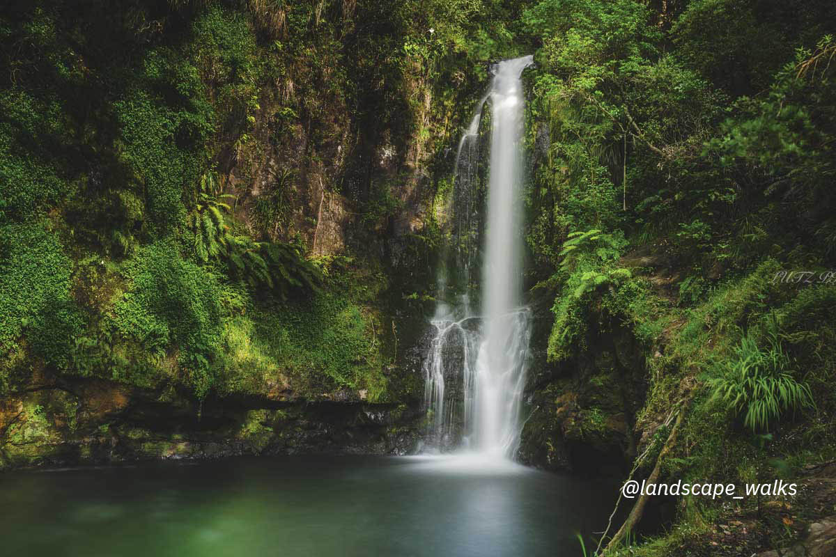
Falls retreat
With Pāpāmoa on radar, why not hit Kaiate Falls after you’ve navigated the trig walk. The falls walk is a mere 0.8 kms (an easy 15-minute stroll) and is a short drive – 12.4 km – from the Popular Lane’s carpark to Kaiate Falls Road via Waitao Road. The three-tier falls are also known as ‘Shag Falls’ because many years ago a large shag colony nested close to the lower waterfall, and the Maori considered them guardians.
A large swimming hole pools at the bottom of falls – perfect for a dip and then a bite to eat – with the picturesque falls cascading in the background. However, if there has been a lot of rainfall prior to your walk, avoid the swimming as contamination could be an issue.
Getting to Pāpāmoa Cultural Heritage Regional Park . . .
From Tauranga – Approx. 20 km, 20 mins
- Travel east on State Highway 2 towards Whakatāne. Approx. 1 km past the Pāpāmoa/Bell Road turn-off on the left, turn right into Poplar Lane. The carpark access is on the right, before you reach the quarry gate.
From Rotorua – Approx. 65 km, 45 mins
- Travel towards Te Puke via State Highway 33. The park is 5 kms after Te Puke on the left. Turn left from State Highway 2 into Poplar Lane.
From Whakatāne – Approx. 80 km, 1 hr
- Follow State Highway 2 towards Tauranga. The Park is 5 kms after Te Puke on the left.